Online Tool for Validating Mangrove Distribution Data Ready
The United Nations Environment Programme’s (UNEP) World Conservation Monitoring Centre has developed an online tool for validating mangrove spatial distribution data within the Canary Current Large Marine Ecosystem (CCLME).
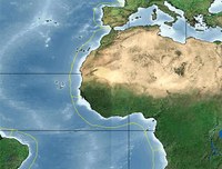
The tool could potentially support the validation of other global habitat datasets such as corals and salt marsh layers. The CCLME Regional Coordination United in Dakar, Senegal, reported 4 July that the overall objective of the project was to review and integrate relevant spatial data for mangroves in The Gambia, Guinea, Guinea-Bissau, Senegal and Mauritania. This forms part of the Global Environment Facility-funded Canary Current Large Marine Ecosystem Demonstration Project 5. Project 5 is the ratification of a regional mangrove conservation action plan and implementation of pilot mangrove restoration actions. The project is in collaboration with the regional Wetlands International and the International Union for the Conservation of Nature offices.
In developing the tool, CCLME worked with partners Wetlands International and the International Union for the Conservation of Nature on the integration of spatial data relevant to mangroves of the CCLME region. The products and data will be used to help UNEP to conduct a feasibility study for mangroves and REDD+ in the Canary Current Large Marine Ecosystem region.
The UNEP-World Conservation Monitoring Centre in England (UNEP-WCMC) and the Regional Network of Marine Protected Areas in West Africa in Dakar, Senegal, are developing a joint proposal to seek funding for further capacity-building for field scientists to use habitat validation tools within the CCLME region.
UNEP-WCMC will ensure that validated mangrove datasets resulting from this project will be made available through the Ocean Data Viewer (http://validation.unep-wcmc.org) in order to provide decision-making support to other stakeholders within the CCLME region.
Regional universities have expressed an interest in using the habitat validation tool as an educational learning resource to support students’ projects focusing on coastal habitats. In order to meet this need, UNEP-WCMC is looking at providing educational support tools based on the habitat validation tool. These tools are currently being developed through a Blue Forests project.